Finding Bana – Proving the Existence of a 7-Year-Old Girl in Eastern Aleppo
Bellingcat is famous for their investigations during the MH17 crisis, with crowd sourcing of OSINT. Now they try to verify whether this girl exist in Eastern Aleppo.
Finding Bana – Proving the Existence of a 7-Year-Old Girl in Eastern Aleppo
Bellingcat is famous for their investigations during the MH17 crisis, with crowd sourcing of OSINT. Now they try to verify whether this girl exist in Eastern Aleppo.
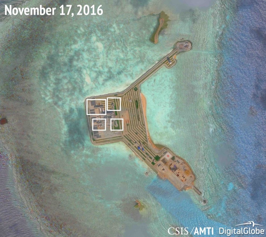
CHINA’S NEW SPRATLY ISLAND DEFENSES
The static defences are built on hexagonal structures on the roof of the island HQ building. Possible anti aircraft guns or CIWS. Usually in the vicinity of radar facilities.
Image from CSIS / AMTI and Digital Globe.
Link to Google Maps
Credits of Mr Yudhishthra Nathan, check out his blog too
https://mappedmusings.wordpress.com/2014/02/15/mapping-our-home-mapping-the-house/
 Source: SPOT Imagery from Google Earth dated 2000-2008-2016
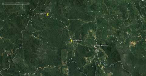
Main causes of deforestation are logging activities along the logging trail in the north west direction and and oil palm plantations to the north, south and east of Gua Musang settlement.
For many nonprofits and social service organizations, limited funds and resources present an ongoing challenge to GIS use. Even when organizations are aware of the ways in which GIS and spatial analysis might be beneficial, they are often limited by a lack of appropriate skills and resources.
The good news, according to Elwood, is that advancements in GIS technology have led to greater availability and more accessible tools. The GIS landscape has evolved significantly, and there are more options available now both in terms of GIS software and training. “When I started in this work 20 years ago,” Elwood says, “the mapping software available cost thousands of dollars and took months to learn. The barriers to entry for map making and spatial data collection are much lower now, due to all the free and low-cost resources that are available.” She cautions, however, that the digital divide has not been done away with entirely; there are still challenges. For instance, free and low-cost mapping tools may be more complicated to use and less powerful in terms of features and capabilities.
For many local social enterprises, social service providers, non government organisations, grassroots organisations and other volunteer and charitable endeavors etc, lack of funding and resources are barriers to adopting geospatial technologies such as Geographic Information Systems.
Social workers and volunteers are often too overstretched to learn GIS skills and lack of the means to get geospatial resources, even if they are aware that spatial information are beneficial to their organisations.
However these barriers can be overcome with new developments of in geospatial technologies.
Drones are a low cost entry level platform for remote sensing.
New wearables solutions and IOT devices are being launched in the market.
Google Maps sparked a race to provide free mapping and geospatial data services.
Open source GIS tools provide the functionality which previously cost thousands of dollars.
Cloud computing and virtualization eliminates the need to maintain servers on site.
However there are still challenges for any organisation trying to adopt new technologies. With this in mind, GAGA Consults is founded to provide consultancy services to help social causes help their clients better.
